Travel
Related: About this forumDoes anyone remember travel pre-cell pre-internet,?
Guessing maybe 1998? Met my husband's family for the first time. We all traveled to Tahoe from 6 different locations and rented condos.
How in the world did we find the condos in the first place? How in the world did we all get there at the same time? Reno airport? How did we find the rental car? How did we find a packy to get blackberry brandy for a ride up the mountain to Tahoe because it's what you do outside with snow - especially with the biggest snowflakes I've ever seen in my life? How did we find a great grocery with the most beautiful California vegetables and fruit I had ever seen?
Have zero recall of hassles and hours on end waiting for people at the airport. Was it a time where we all just chilled and basic services were never that bad that we would remember 20-something years later?
bottomofthehill
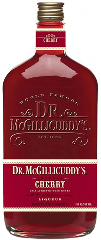
(8,853 posts)Dr McGillicuddys was my hilltop pick me up.
It was cold skiing the “packed powder” of the ME, VT and NY hills.
Laura PourMeADrink
(42,770 posts)website before MapQuest![]() - just to be obstinate - can't recall name.
- just to be obstinate - can't recall name.
Never heard of McGillicuddys ![]() yikes there's cherry and menthol and butterscotch!
yikes there's cherry and menthol and butterscotch!

wackadoo wabbit
(1,217 posts)City street maps, state highway maps, county maps, state guidebooks (with hotel/motel listings), and anything else that you could think of. It wasted a lot of paper.
bottomofthehill
(8,853 posts)wackadoo wabbit
(1,217 posts)that way. Also, we were into driving "blue highways" (i.e., off the interstates) and were likely as not to take a road just because it looked interesting.
Alice Kramden
(2,415 posts)The enjoyment ended post 9-11. So stressful after that.
Laura PourMeADrink
(42,770 posts)No ID. We used to buy tickets with a generic name so anyone could use it like Pat Smith![]()
Response to Laura PourMeADrink (Original post)
Chin music This message was self-deleted by its author.
Laura PourMeADrink
(42,770 posts)And to get to flip a page over was a great treat.
House of Roberts
(5,733 posts)Drove to the town I wanted, stopped at a convenience store, bought a map, and asked the clerk to show me where I was, and where I wanted to go.
Then I drove there. It wasn't that difficult.
Laura PourMeADrink
(42,770 posts)a map quickly. There is a trick to it ![]()
Not too long ago, on NPR, they talked about how we are not using a part of our brain that we used to use. With maps, we used to learn about spatial relationships and distances and landmarks. With GPS, you learn nothing
elleng
(136,616 posts)LOVE maps, and have many old ones from AAA, all properly folded!!!
CTyankee
(65,197 posts)Hubby won't give up the old ways. I've learned to indulge him. It really makes him unhappy not to have things where they used to be.
elleng
(136,616 posts)getting NEW 'old' AAA maps (and Tour Guides!) Will pass through Conn.
![]()
CTyankee
(65,197 posts)Hope you have good weather...we have the Yale Bowl tomorrow. The Bulldogs are playing Cornell. Looking forward to the final game, against Harvard. It was a point of contention in our family because my ex-husband went to Harvard (and never let you forget it) and that's home this year. My ex passed away last month so there will be no rivalry.
elleng
(136,616 posts)Staying along the coast (preliminary plans, anyway,) so not sure how many colorful leaves we'll see, in/around Providence, Portsmouth and Portland. May catch some on trip back, inland NH and VT (and western MD!)
CTyankee
(65,197 posts)POTUS, due to an inability to keep him/her safe. However during the Obama administration, one of his daughters (at Harvard then) attended and, on the Yale side, Paul McCartney (nephew at Yale I think). Year before last (no Ivy League games last year due to Covid) there was a demonstration on the field by climate activists from both schools. They sat down on the field (Sam Waterston, Yalie, was among those demonstrating). The governors of both states were there and tried talking to the demonstrators and they were persuaded to leave but only after it had grown rather dark (no lights at the Bowl). They left and the game proceeded and Yale won. We had left thinking Harvard had won and afraid it would be too dark to find our way out to the parking area. It was only later when we learned Yale had won, scored twice.
ms liberty
(9,859 posts)My husband and I talk about this a good bit. He works for Fed Ex Express as a courier. When he went to work there, they all used maps. Consequently, after nearly 20 years he knows all - and I mean all - the roads in at least 5 counties and 3 cities in our region.
My dad thought it was important for his kids to know how to read a map, so I grew up with them and I still use them. I hate using a map on my phone, and I'm terrible at it.
wyn borkins
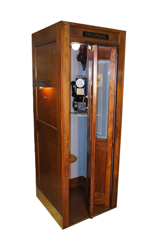
(1,119 posts)Always traveled with a roll of dimes as well as a roll of quarters for the phone booths (the wooden ones with the folding doors). Also, went to AAA and got a TripTik purposely marked for my entire journey.
Laura PourMeADrink
(42,770 posts)
wyn borkins
(1,119 posts)That's them! However, the ones I recall were not nearly that fancy but they did have an abundant supply of rather tasty chewing gum stuck underneath that little shelf under the phone. Also, I have never seen one like yours, kitted-out with lights both inside and outside as well...very nice.
CTyankee
(65,197 posts)bullshit) and I told her the story of calling my doc on a pay phone when I started having contractions (the landline phone in our apt. was not working at the time).
I anticipated her saying "What's a phone booth?" She could hardly believe that people went into a little box on he street to put coins in a phone to call anyone.
Walleye
(36,011 posts)nilram
(3,003 posts)And now, in my area, it’s illegal for me to pick up the phone and look at it – even if I’m glancing at a map program that’s clearly showing me the next step.
(No, I haven’t found a suitable mount for my phone that doesn’t get in the way.)
And then there was meeting up, say, at the state fair, at a particular place and time. Seems like it must’ve gone wrong once or twice, but either it was inconsequential or I have a bad memory. Clearly, must’ve just been inconsequential…
TreasonousBastard
(43,049 posts)the best ones.
I had a huge collection of them at one time.
RainCaster
(11,602 posts)No cell phone, no Google maps. No English signs in the train stations. Any awesome adventure, and I truly felt out of place at 6 foot tall. So easy to get around now, as the signs are bi-lingual.
elleng
(136,616 posts)Someone mentioned AAA Trip Tiks, and lots of AAA maps, all in (glove compartment.)
left-of-center2012
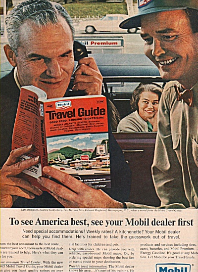
(34,195 posts)I planned a week's vacation to D.C. around 1968 using 'Mobil (gasoline) tour books' at my local library.
Booked a hotel room via USPS postcard.
Made an itinerary of places to see and how to get there.
Yes, folks traveled before the internet.
My mother traveled from Texas to Ohio in the 1930's with 3 toddlers.

Laura PourMeADrink
(42,770 posts)people must have planned everything so far ahead of time huh.
Growing up I don't remember us making reservations at all. Have vivid memory of driving and stopping and my dad would run in and then he would come back out and say no vacancy. Then we would just drive to the next place![]()
qazplm135
(7,509 posts)I drove from TN to TX in 1994 when I got transferred to Fort Hood, and then from there to El Paso in 96 when I left to finish school.
I am pretty sure when I drove from El Paso to Houston for law school in 98 was probably the last time I used a map.
After that I think I started using the internet for directions for long distance.
And then obviously in the smart phone era, google maps.
teach1st
(5,969 posts)Drove from Florida to the west coast a few times in a VW bug. Relied on maps and verbal directions from locals. Found the Rainbow Festival in Granby. Found the surf spots we wanted to find, and found the house in Berkeley.
Started hitching solo to the west coast from Florida with less than $20 in my frayed patch-jeans pocket, no maps, no real goal. Got a ride through Colorado with some freaks from Kansas in a van packed full of shit weed. After California, I ended up in New England and finally in NJ for an extended stay. Got back to Florida with more money than I started with, thanks to giving strangers and a few small-town police sheriffs who let me stay as a guest in their jails (no arrest, just let me crash), complete, at one Georgia station, with a wonderful southern breakfast like I was in an Andy Griffith show ("Son, you should cut your hair...people 'round here don't cotton to the hippie look" ) .
I got lost, I got waylaid, I got betrayed. I stayed in one spot in Reno for eight hours before getting a ride, I slept in the woods in the driving rain. But I went with the flow and the flow usually met met my needs. Things have certainly changed.
Laura PourMeADrink
(42,770 posts)once absolutely no big deal.
Hestia
(3,818 posts)Hitchhiking was huge during the Depression and people continued to do it after coming home the war. Not too many people could afford a car back then.
https://timesmachine.nytimes.com/timesmachine/1942/12/23/85622477.html?pageNumber=16
viva la
(3,822 posts)Like... "We'll meet at the sw corner of the plaza... " and if you missed the bus or can't find each other, there's nothing you can do to locate or notify.
Laura PourMeADrink
(42,770 posts)In other words if somebody didn't show up people use their own resources to figure out what to do? Like call someone else? Or the missing person figured out who to call to get your message or something like that. It did seem like general services were more dependable a long time ago. But cars not so much. Seems like cars were always breaking down.
viva la
(3,822 posts)The last time I had a flat tire was in 2015.
That's a life improvement, as I've always had to have only used (sometimes very used) cars, and couldn't afford major repairs.
Laura PourMeADrink
(42,770 posts)On my 2006 solara.
In My memory it was always overheated engine, accelerator bad, and flat tires.
keopeli
(3,579 posts)If you were a map person, everyone wanted you to join them.
CURRENT maps were important. The formula was simple:
You start at point A (where you are).
You figured out where you wanted to go.
You opened the map and found the street in the index which told you the page it was on. (11052 57th St is on page 274).
You found the page and backed out to the closest highway, marking it with a pencil.
You followed the HWY out on the zoomed-out map that showed only HWYs.
You backed up until you got back to point A.
When traveling long-distance it was very helpful to have a navigator in the passenger seat.
It was also very helpful to call long-distance in advance for tips on how to get there. But, make it quick. Long-distance calls were expensive and charged by the minute. And, they needed to be home when you called.
Planning ahead was critical. Although, some of my favorite trips were those where we set out without plans and just wandered in a certain direction until we got somewhere.
Honestly, it was a lot of fun!
Laura PourMeADrink
(42,770 posts)Finding the coordinates. Just think how much we used our brain back then.
viva la
(3,822 posts)The GPS on the phone is great, but on that little screen, I can't get a sense of, you know, where Nebraska is in relation to Minnesota. Need that paper!
I still can't reliably re-fold those maps though!
Major Nikon
(36,911 posts)Then checked your location on your map and plotted the new courseline
Mosby
(17,567 posts)To take the stairs up into the plane.
And when we traveled by car my mom was the navigator using the maps my dad picked up at AAA. It was an important job, and they were a pretty good team.
dooner
(1,217 posts)Travel guides checked out from the library were excellent for recommendations on places to stay, eat, visit, etc.
Then you could just call to make your reservation. Once you found a guide that matched your taste in travel, it was easy.
csziggy
(34,189 posts)Used AAA Travel Guides to locate hotels and restaurants. Had a book about archeological sites, plus the AAA Guide to find places to sight see.
The whole trip, we had three reservations - Grand Canyon for three nights, a few nights at the Jack Tar Hotel in SF, and in Big Bend National Park in Texas. The rest of the time we just winged it. Had to leave the Grand Canyon a day early to avoid getting snowed in, drove straight through to Death Valley since I didn't want to stop in Las Vegas. Followed the snow plow into the mountains to get to King's Canyon.
Fantastic trip, but I am amazed we didn't have any serious problems on the whole trip. One of my best memories is seeing the Rocky Horror Picture Show at a theater on Market Street with serious contact highs there was so much pot smoke in the room - before everybody was dressing up or singing along.