Anthropology
Related: About this forumThis Interactive Map Shows Which Indigenous Lands You Live On
Updated: November 1, 2023 | Originally Published: October 13, 2022
The nonprofit behind the tool wants people to learn the history of the spaces they inhabit
Jacquelyne Germain
Staff Contributor

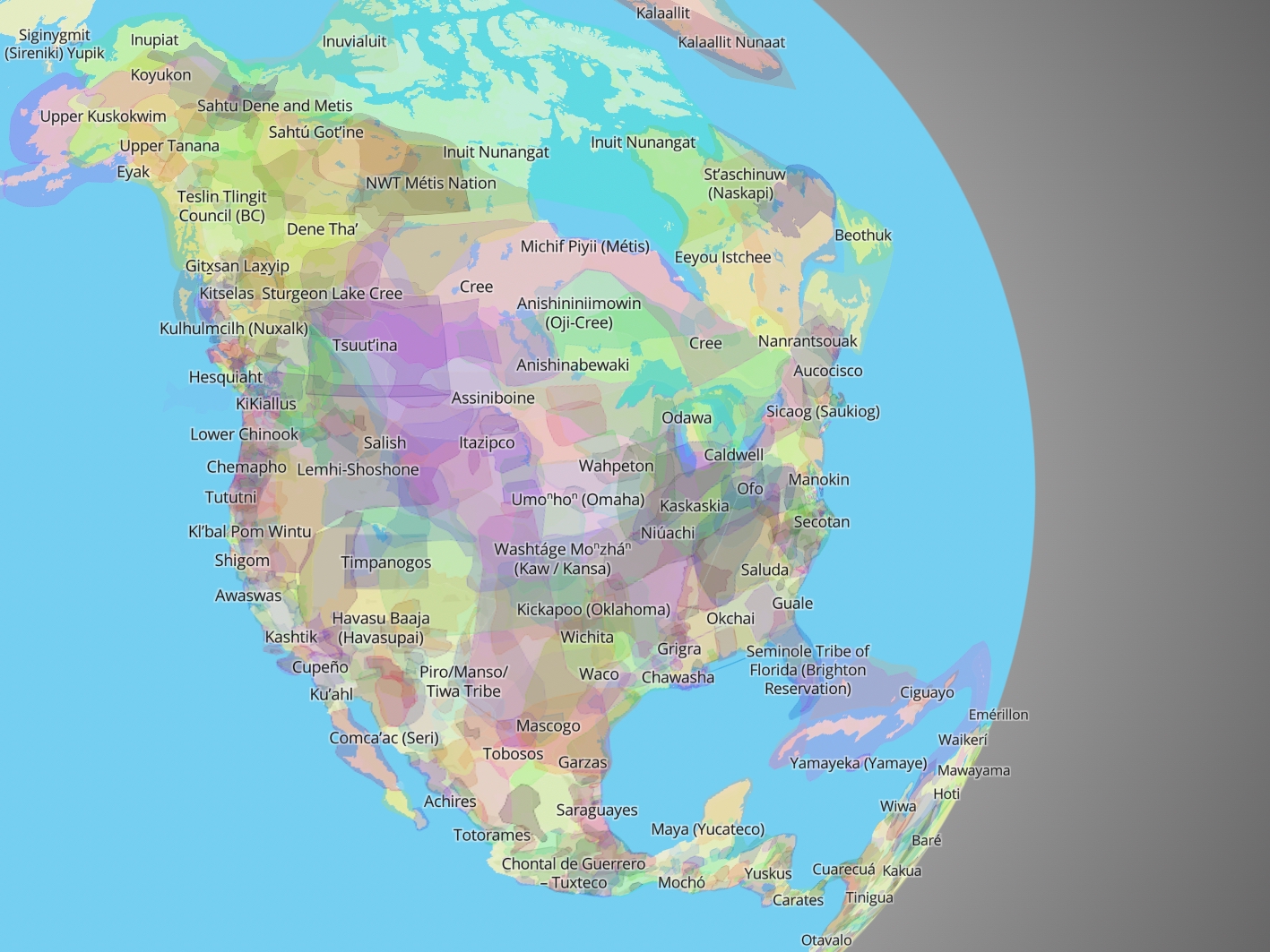
A screenshot of Native Land Digital’s interactive map Native Land Digital
In 1990, the month of November was officially designated Native American Heritage Month in the United States. “Native American Indians were the original inhabitants of the lands that now constitute the United States of America,” the government resolution read, noting Native peoples’ “essential and unique contribution to our nation.” This November, you can learn more about North America’s first inhabitants by finding out which Indigenous lands you live on, using a collaborative, interactive map.
Since launching on Native-Land.ca in 2015, the tool has helped people discover the history of the land they inhabit. Created by Victor Temprano and now overseen by Indigenous-led nonprofit Native Land Digital, the map first functioned as a “resource pointed at settlers and non-Indigenous people to, in a not-too-confrontational way, start thinking about Indigenous history,” Temprano told Mashable’s Heather Dockray in 2018.
Today, Native Land Digital is focused on improving both Indigenous and non-Indigenous people’s relationships with the lands around them through education. Per a Facebook post, they “hope to strengthen the spiritual bonds that people have with the land, its people and its meaning.” They strive to “create and foster conversations about the history of colonialism, Indigenous ways of knowing and settler-Indigenous relations.”
The map is built from user contributions and feedback, with developers consistently updating and editing it using new information. In May 2023, Native Land Digital collaborated with the Partnership for the National Trails System to launch Native Lands, National Trails, a map identifying the Indigenous lands hikers trek through on trails. Kiana Etsate-Gashytewa led the project, and, as she tells Conde Nast Traveler, Native Land Digital’s data is unique, inclusive and encompassing.
More:
https://www.smithsonianmag.com/smart-news/interactive-map-shows-you-what-indigenous-land-you-live-on-180980920/
CaliforniaPeggy
(152,315 posts)HeartsCanHope
(747 posts)As CaliforniaPeggy said, our acknowledgment of the Indigenous tribes that were here before us is long overdue. Nothing will ever make up for the damage we have done to their culture and the cruel treatment of their people, but acknowledgment is the first step. Take care.
Permanut
(6,701 posts)Many of the names on the map survive in Oregon, and there have been great efforts to preserve the languages and cultures - also very cool.
MrWowWow
(431 posts)Will know who to send the land lease money to now. Great!
calimary
(84,502 posts)Well, at least we have that one settled!
![]()
calimary
(84,502 posts)I didn't know there were so many tribes in what we think of as the U.S. mainland. Really fascinating!
Thanks for finding this, Judi Lynn!
Hermit-The-Prog
(36,602 posts)ᏣᎳᎫᏪᏘᏱ Tsalaguwetiyi (Cherokee, East) ↗
S’atsoyaha (Yuchi) ↗
Shawandasse Tula (Shawanwaki/Shawnee) ↗
Adena Culture ↗
Wonder Why
(4,653 posts)Kali
(55,829 posts)than the narrative of European colonialism in the text. things weren't perfect harmony prior to the late 16th century.
I may sound like a rightwinger on this, but the land I live on is MINE. sure there is interesting history (and prehistory) here, but it is mine at the current moment.